More Views of The Columbia Gorge

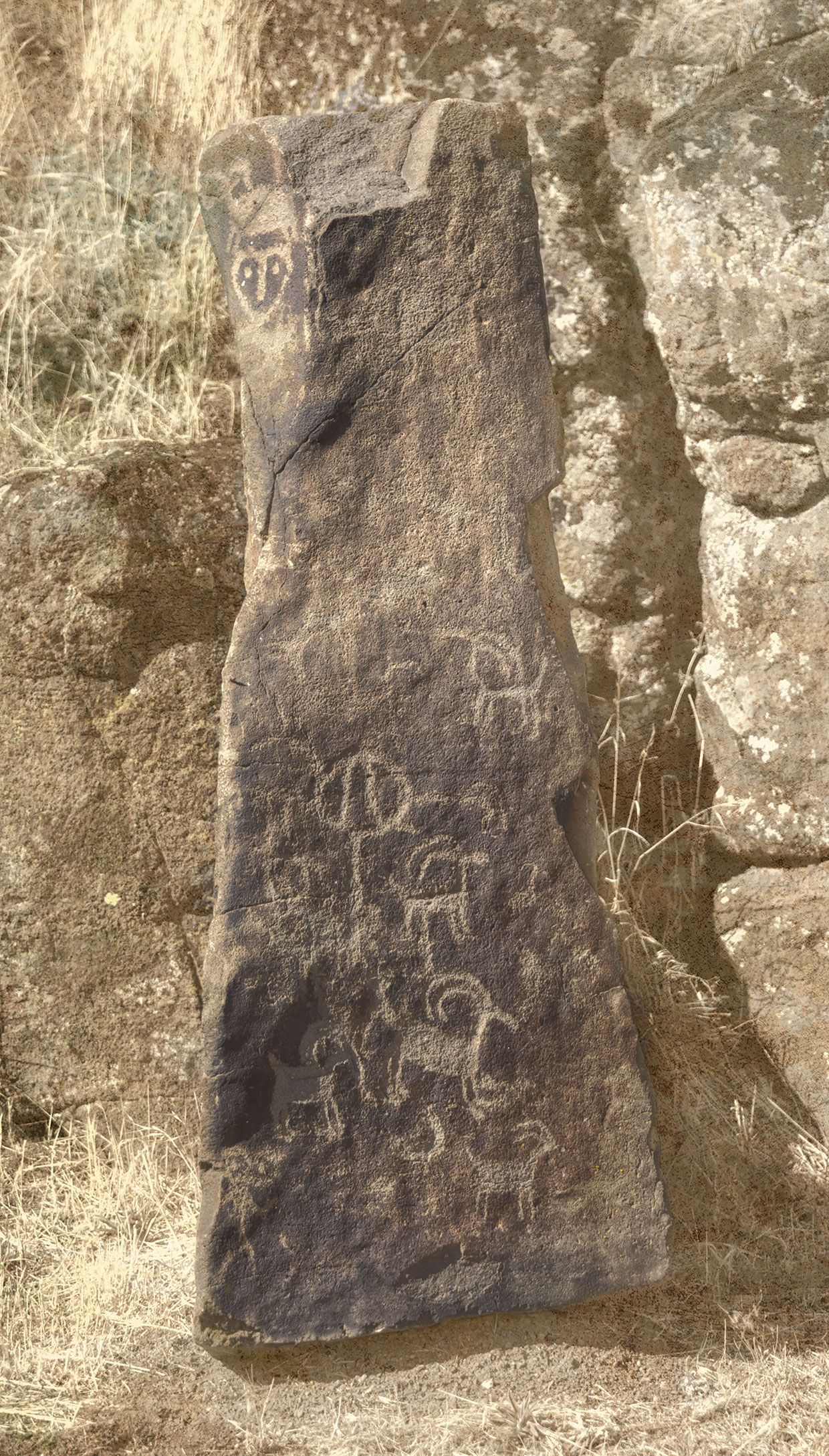
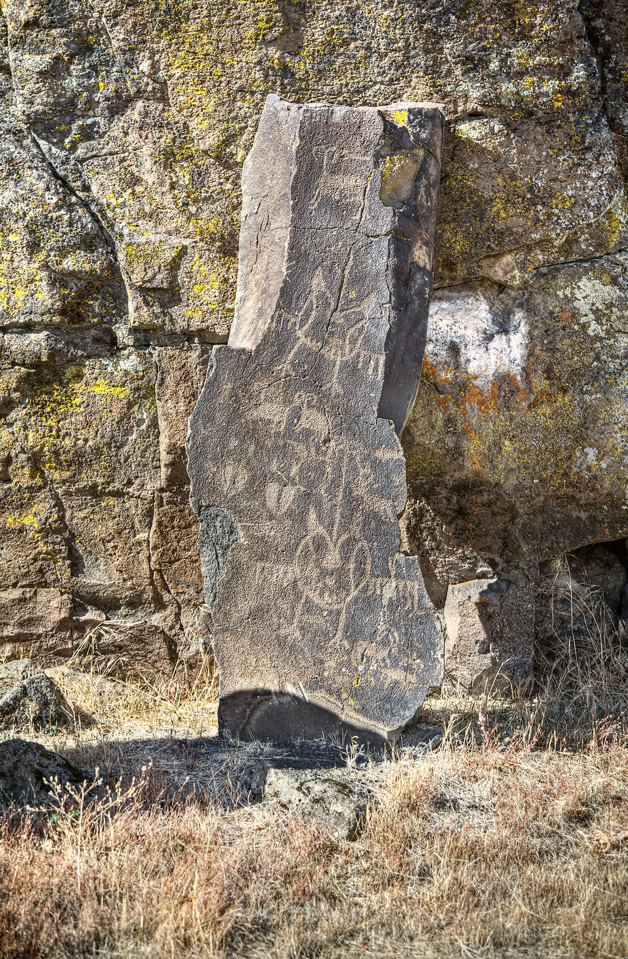
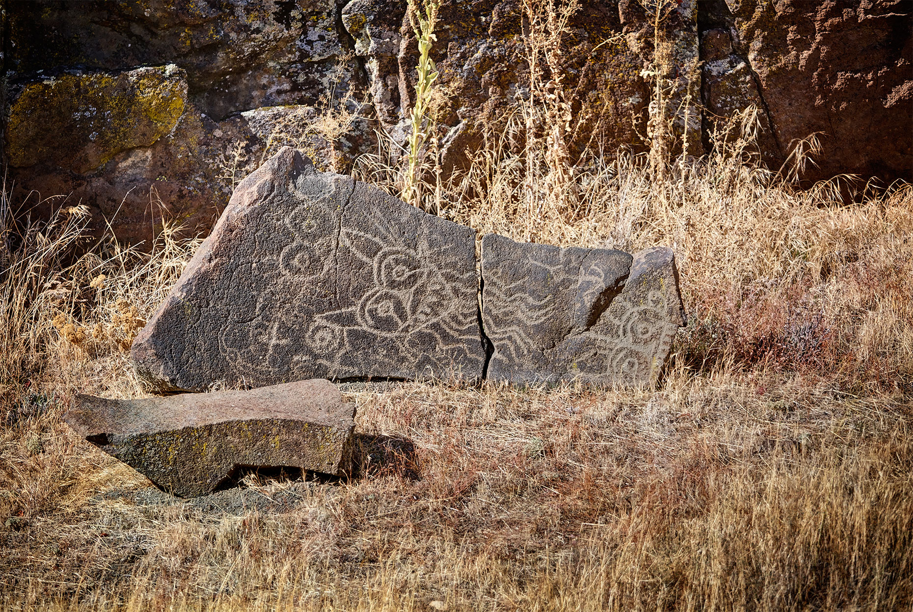
The Indian petroglyphs featured at Horsethief Butte are a relatively recent discovery for me, but these rocky cliffs seem forever,

Ridgeline2

which perhaps explains why this Photoshopped version

Ridgeline1

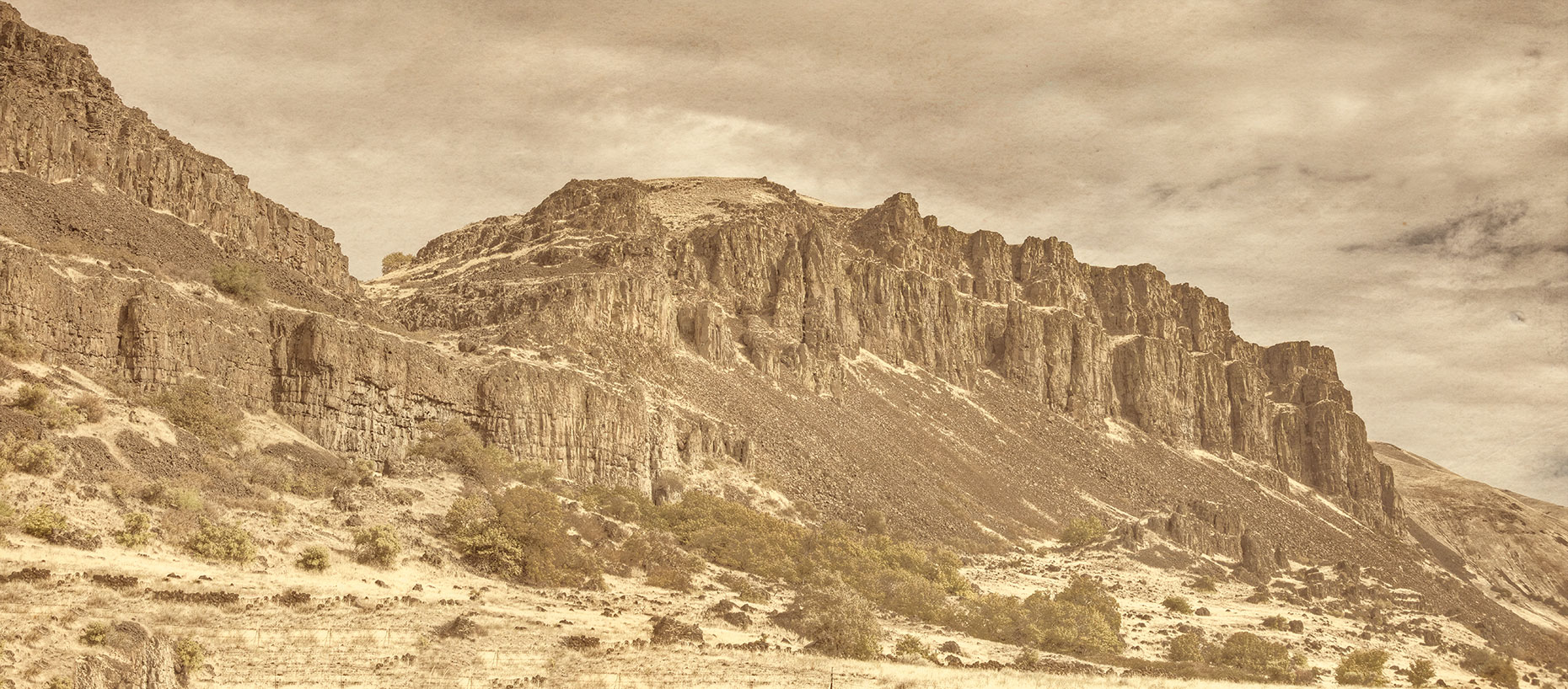
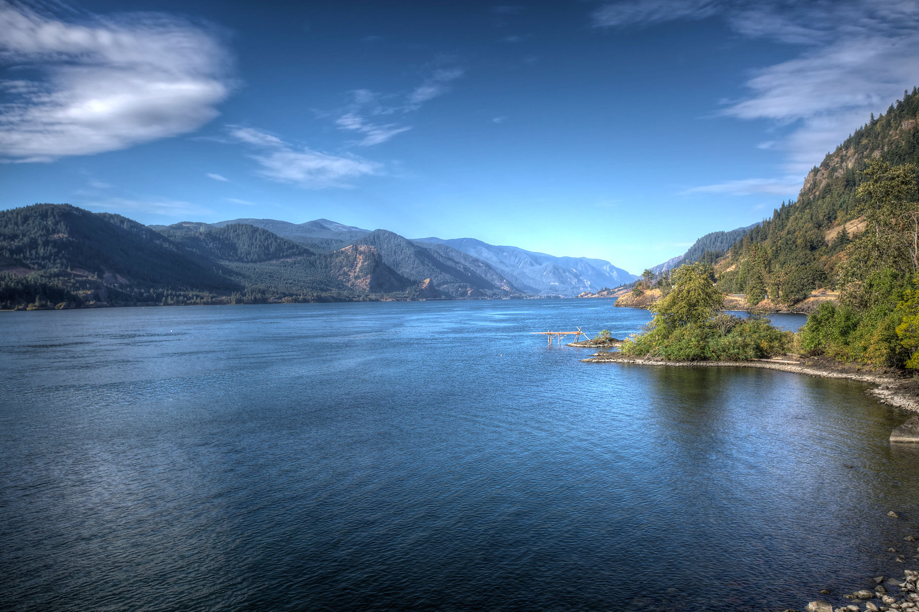
seems more “realistic,” as it were, than the first photo. More often than not when my dad visited us on weekends when I was a kid we hiked through cliffs like this to reach the Klickitat river. These rocky cliffs took on an even more mythic quality while listening to my mother’s Uncle Fred retell his life-long adventures ranching and fishing around Goldendale, especially stories featuring rattlesnakes.

Heck, if I hadn’t heard so many tales about timber rattlers as a child I might even have hiked up to the top of this rock pile

CrossOnHill

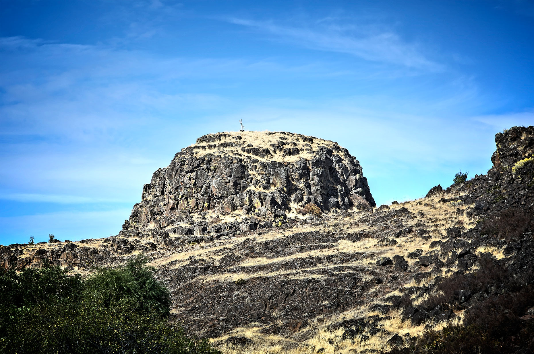
to see if there was any explanation of the cross sitting atop of it.

Before I do that, though, I guess I should hike the trail to Horsethief Butte, something I would probably have done long ago

HorseThiefButte2014

if the hike description didn’t shout watch for POISON OAK and RATTLESNAKES. I’m not sure which of those two I’m more afraid of, though I suspect the greatest danger is actually the poison oak since I had some nasty cases of that as a kid and I’ve never had a snake bite, despite having seen quite a few of them.

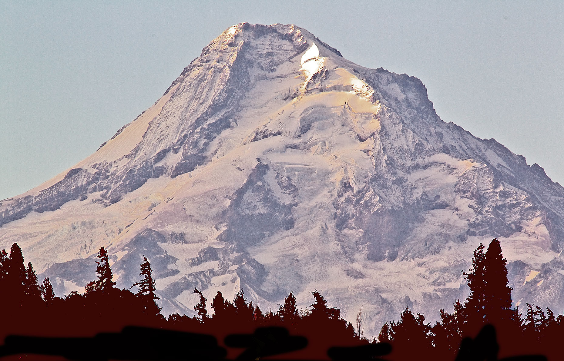
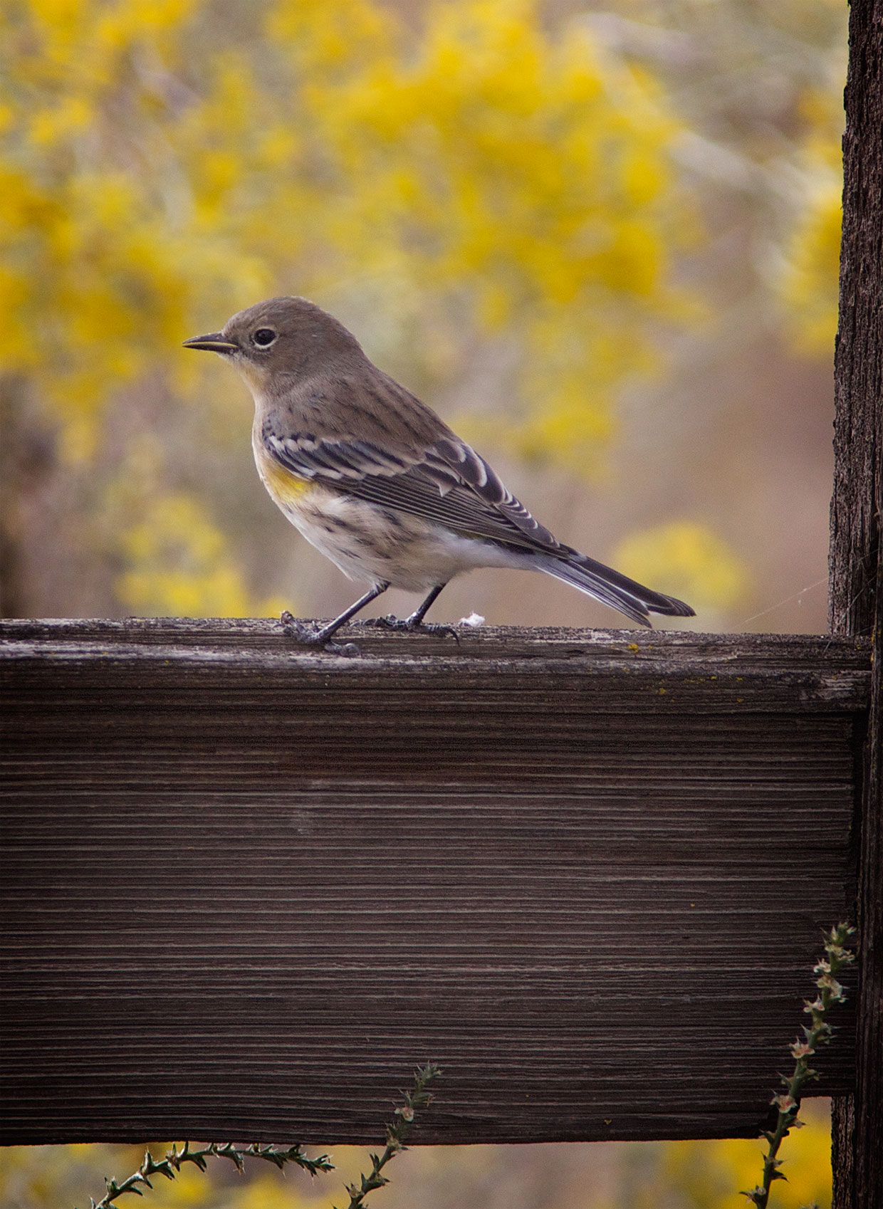
In retrospect I should probably have turned left at Biggs junction instead of driving all the way to the Umatilla National Wildlife Refuge because the only shot I got for my efforts was this one of a Yellow-Rumped Warbler.

UmYlwRmpdWrblr

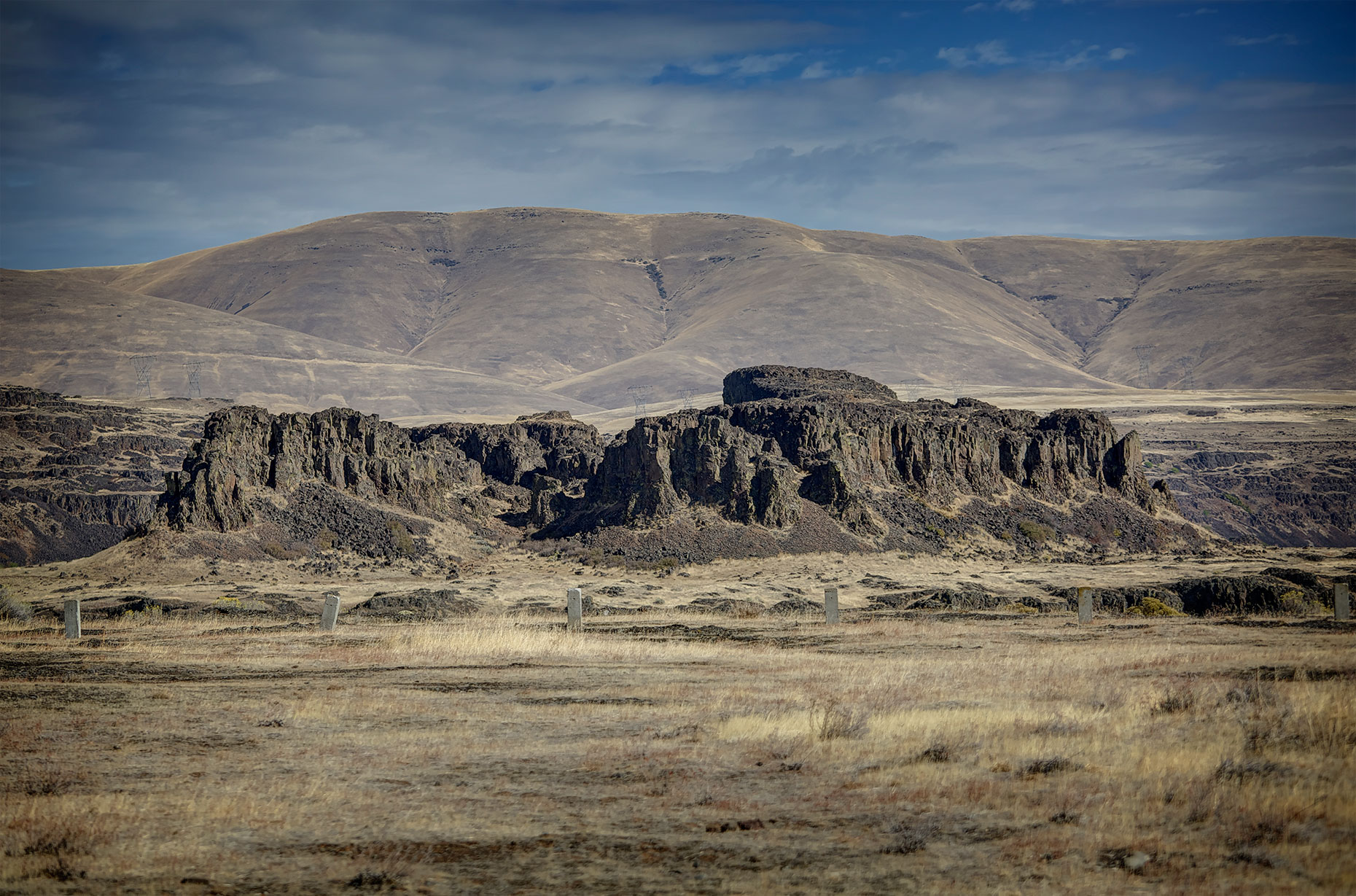
I’d actually hoped to get a shot of some of the old rock walls I’d seen on previous trips, but either they had finally fallen down or been removed by current residents, for there was none to be seen. I guess I could have taken shots of the vineyards that seem to have taken over this part of the Gorge, but vineyards are all too common today.

Still, if I hadn’t made the drive to Umatilla I would have missed this beautiful sunset.

Snst

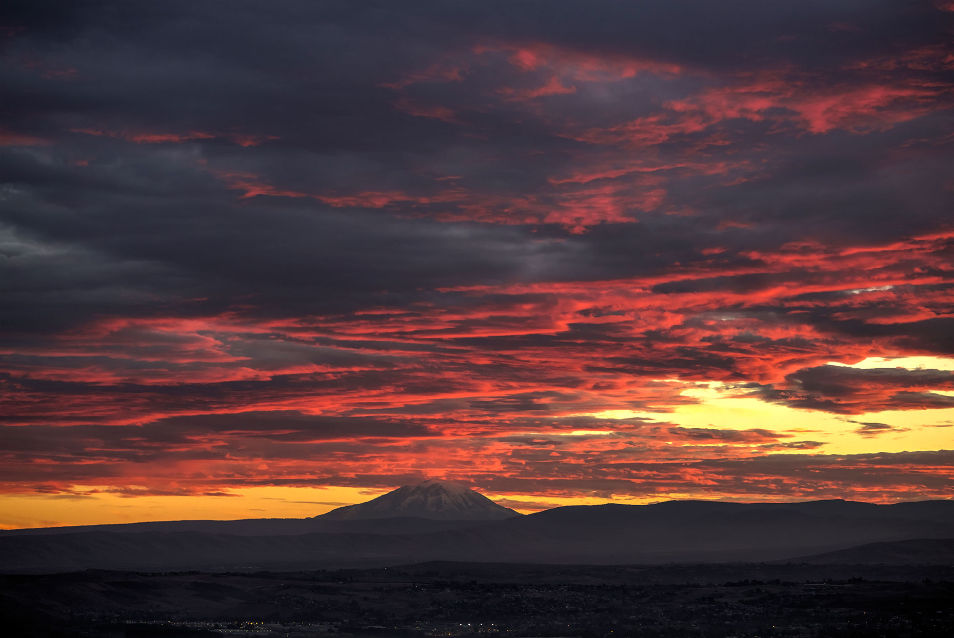
Even rain clouds can be beautiful given the right circumstances, I guess, though the threat of rain is what finally got me home a day earlier than I had planned.

Ancestral Home

It’s impossible for me to revisit the Columbia River without reliving the past. Although I only lived there for a year, from 4 to 5 years old, some of my oldest memories come from that period; most of what precedes that time is only a blur. Goldendale was also my maternal grandfather’s home; he lived on a ranch, broke horses, and drove cattle to market across the Columbia River. I attended my first rodeo there and can still remember seeing Brahma bull riders and Indians dressed in their best finery.

Although I wasn’t aware of it as a child, the area was an important one to the Indians and still is as the Yakima Indian Reservation has to be one of the largest in Washington State. Of course, it wasn’t until this trip that I learned how important salmon fishing was to the natives, that there was a wide-spread economy based on the trading of dried salmon.

Ironically, though, the Old-West memories on this trip were triggered by the sight of a Buffalo herd alongside the road even more so than seeing the Indian fish camps earlier.

Buffalo

I couldn’t resist stopping and getting a shot, even though I’m pretty sure that Buffalo were never native to this area, though they certainly seem better suited to the area than cattle. Weather in the eastern part of the Columbia Gorge is brutal, particularly in the winter when high winds and bitter cold often join together to make life difficult for those willing to live there.

After seeing the buffalo I decided it must be time to put on R. Carlos Nakai’s Canyon Trilogy. “Dawn’s Mirage: Ancestral Home” seemed like an appropriate accompaniment to my journey.

I’m pretty sure that if Buffalo were indigenous here they would have shown up in the petroglyphs along with the goat, deer, and elk.

Ptro1

Of course, that line of thinking would seem to indicate that salmon should also appear in the petroglyphs and they don’t, at least not in the ones I’ve had the privilege to view. Wonder why? It’s certainly an important part of Coastal Indian art.

Did I mention that I stopped again to see the petroglyphs at Horsethief Butte? Very hard to resist that temptation when you’re thinking about Columbia River Indians. I find these enigmatic figures irresistible and I seem to learn something new every time I study them. I’ve always thought the figures with “horns” were a demonic figure, but when a reporter suggested that there were owl figures, it just took one look at the feet to realize that he was probably right.

Ptro2

However, this figure which has somewhat similar ears still looks demonic to me.

Ptro3

What do you think? In reality it seems to be all speculation because there’s little consensus on how old the petroglyphs are, much less what the symbols represent.

Coincidentally, a little further up the river I stopped to see a “historic train” and discovered these local artists painting a mural using symbols taken from the petroglyph.

Mural

I thought that since they used the symbol in the upper right hand corner that they might know what it meant, but they didn’t, and since they were local artists who obviously respected the symbols I assume its meaning must be generally unknown

What I did learn from talking to the artists is that I have managed to miss the most famous petroglyph at the site, the one in the upper left hand corner. It’s located behind the area that has been roped off to prevent vandalism. It’s clear that I’m going to have to call and sign up for one of their scheduled walks in the restricted area next Spring, since there are none scheduled in the late fall and winter.

Always Take the Long Road Home

After two straight days of hiking up hill, I didn’t think I wanted to do another Columbia Gorge or Mt. Hood hike, but I didn’t see much reason to head straight home since Leslie was going to be gone for the weekend. So I decided to take the long way home and follow the Columbia River

BeaconRockColumbia

eastward to Umatilla and then head north. I spent the night at Beacon Rock State Park and headed out in the morning with designs of idling the day away taking pictures.

It didn’t take long to find a place to stop and get my first shot, the north side of Mt. Hood,

2014MtHood

quite a contrast to the shots taken the day before from the south side of the mountain. Of course, this is also a telephoto shot and only shows the top of the mountain. Still, it seems there’s more snow on the north side of the mountain than on the south side.

It’s hard to spend a day in the Gorge and not learn something new about it if you’re paying attention. This trip I noticed that the Indians had set up a traditional fishing platform, seen off the little green peninsula in the center right of the shot (as always, click to enlarge).

IndianFishing

Coincidentally, I stopped at a pullout near Celilo Falls, which, as it turns out, was one of the most important fishing and trading areas for local Indians and served as the center of a widespread trading network.

CeliloFalls

Of course the falls disappeared in 1957 when the Dalles Dame was built. In this shot taken from a few miles up the road, looking back at Mt Hood towering over these arid, rocky cliffs you can actually see the bridge in the background of the previous video.

LookingBackFromLyle


At Maryhill’s Stonehenge, Mt. Hood finally disappears from sight when you reach the plateau above the Columbia.

FromMaryhill

I Finally got to Hike with Terry and Bill

I hardly had time enough to clean my pickup up from our California trip before I headed out to Vancouver to hike the Columbian Gorge with Terry and Mt. Hood withBill. Now that I’ve purchased an Off-season States Park Pass, I can stay at any open State Park for free, or for $10 if I connect up to electricity or water. Hopefully that means I’ll be able to hike the Columbia Gorge or Mt Hood more this year, at least when the weather cooperates.

Unfortunately, in my rush to throw everything together I left my camera in the camper when I hiked Multnomah Falls to Wahkeena Falls on the first day with Terry, which, as it turned out, might not have been entirely a bad thing. Terry was obviously in much better shape than I was, weighing 147 pounds and with a resting heart rate of 47. Even without a camera he had to wait several times on the uphill grade while I stopped and gasped for breath. I’m sure lugging a camera and an extra lens along would have made it even harder to keep up. It was a great day, though, and I was thankful that Terry had agreed to take me along with him. It took a couple of years for us to put a hike together because the weather has been remarkably uncooperative in the past. Hopefully we’ll be able to get together again this winter or next spring.

I wasn’t about to forget my camera two days in a row even though I knew I would probably have as much trouble keeping up with Bill the next day as I did keeping up with Terry. Knowing I’d hiked the day before, Bill chose Tom, Dick, and Harry Mountain, a hike we used to do in late Spring or early summer when the mountain snows were just beginning to melt. Even though it’s at a higher altitude than the Gorge hike, it was shorter and, I think, less steep, though I certainly wouldn’t swear to it as we climbed steadily.

Luckily it was relatively cool, and the dense forest at the beginning of the hike helped keep it that way. I love walking in Pacific Northwest forests.

FlnLogs

As we approached Mirror Lake we could look ahead at our destination, Tom, Dick, and Harry Mountain. It didn’t seem nearly as close as it looked here when we started the climb, particularly when we emerged from the forest into the clearings on the top of the ridge.

TomDickHarry

There was no arguing, though, that the views from the top were worth the effort, though Mt. Hood looked as bare as I have ever seen it in the 40+ years of hiking it.

HoodFrmTDH

I was better able to appreciate the Fall colors on the way down than on the way up when I spent most of the time staring down at the trail.

FllClrs

We stopped at Mirror Lake to get a shot of Mt Hood peeking over the firs. Unfortunately, there was a little too much breeze for the lake to live up to its name.

HoodFrmMrLak

It made me resolve to get back here in Fall or early Spring when Hood has more snow on it to try to get a better shot of Hood and its reflection.

It was another great hike, though my legs felt a little the worse for wear after two days of the toughest hiking I’ve done all summer. Walking on flat trails or indoor tracks, even when you jog part of the time, is not the same as hiking up and down steep trails. I need to do a lot more trail walking.